 |
|
Desktop
Development » Miscellaneous »
General
Beginner License: The Code Project
Open License (CPOL) a little Virtual Earth ControlBy Andrea_86A small introduction to load Virtual Earth Maps into C# |
Javascript, XML, C# 2.0,
C#Windows, .NET, .NET 2.0, Win2K, WinXP, Win2003, Vista, Ajax,
VS2005, IE 6.0, IE 5.5, VS, IE, IE 7, Dev Posted: 14 Aug 2007 Updated: 2 Jun 2008 Views: 8,116 | ||
|
| |||
|
|
| ||||||||||||||||
- Download VEarth_Bin_Sample.zip - 38.0 KB Download sources (Different from the description; I edited it completely) - 14 KB
Introduction
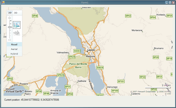
I simply want to realize a User Control to load VEarth Maps into a Windows Form.
The Main problem is that you can load these maps in HTML pages.
So.. i will load in a WebBrowser Control... but a new problem occurs... capture events from HTML pages.
Background
If you use these maps for commercial purposes; read the Microsoft license ($$$$).
To save maps and copy pictures, i use a class from SharpDevelop (Juergen Thomas, Berlin (Germany) - http://www.codeproject.com/csharp/FormPrintPackage.asp).Using the code
Using this control is very easy.
Create a New Windows Forms Project, then include the DLL as component.
Insert the Control in the form and simply call the method:
vEarthControl1.ShowInitialMap();
There are various method to control the map and the visualisation, I think no explication is needed:
// To Show the initial map
public void ShowInitialMap()


// and to close the map
public void unInit()
This methods are to change the map type and to show (or hide) the dashboard, and change it's style.
public enum DashboardStyleEnum  {
       Small,
       Normal,
       Tiny
}
public void DashBoardShow()
public void DashBoardHide()
public void DashBoardSet(DashboardStyleEnum dStyle)


public enum MapStyleEnum  {
        Road ,
        Aerial ,
        Hybrid ,
    BirdsEye
}
public void SetMapStyle(MapStyleEnum mStyle)
To move in the map and zoom:
All Coordinates are in decimal
format.
public void GoToCoordinates(double Latit, double Longit)
public void SetZoomLevel(Int16 zLevel)
public void ZoomOut()
public void ZoomIn()
public void ZoomWorld()
public void ZoomBest()
To add and remove pushpin on the map:
public void AddPushpin(Int32 IDPush, Double lat, Double lon, String Descrizione)
public void AddPushpin(Int32 IDPush, Double lat, Double lon, String Descrizione, String iconAddress)
public void RemovePushpin(Int32 IDPush)
public void RemoveAllPushpins()
To save the map and print it:
public Bitmap GetMapImage()
public Boolean SaveMapAsBitmap(String FileName)
public Boolean SaveMapAsBitmap()
public void PrintMapDefaultSettings()
public void PrintMapPreview()
public void PrintOptions()
Advanced methods, do not use them if you don't know how you can send as
parameter!!!
I declared public to allow everyone send different
command directly to the map, based on SDK specification:
public void ExecuteCommandOnMap(String commandText)
public void ExecuteCommandOnMap(String commandText, String commandParameters)
public void ExecuteCommand(String commandText)
public void ExecuteCommand(String commandText, String commandParameters)
The two events; always handle them to avoid a noisy sound when the mouse is on the map:
public class OnMoveOnMapEventArgs : EventArgs
{
public Double Lat;
public Double Lon;
public DateTime ora;
}

private void OnClickOnMap(object sender, VEarth.OnClickOnMapEventArgs e)
private void OnMoveOnMap(object sender, VEarth.OnMoveOnMapEventArgs e)
Points of Interest
Virtual Earth SDK: http://msdn2.microsoft.com/en-us/library/bb429619.aspx
History
uh.. first version :p
Discussions and Feedback
![]() 16 messages have been posted for this article. Visit
http://www.codeproject.com/KB/miscctrl/Virtual_myEarth_Control.aspx
to post and view comments on this article, or click here
to get a print view with messages.
16 messages have been posted for this article. Visit
http://www.codeproject.com/KB/miscctrl/Virtual_myEarth_Control.aspx
to post and view comments on this article, or click here
to get a print view with messages.
| PermaLink
| Privacy | Terms of
Use Last Updated: 2 Jun 2008 Editor: |
Copyright 2007 by
Andrea_86 Everything else Copyright © CodeProject, 1999-2008 Web09 | Advertise on the Code Project |